
What a terrible disappointment it was for many of the emigrants: South Pass. This was the way to cross the Great Divide, the only passable route over the Rocky Mountains. High and spectacular mountains is what they had expected, a very narrow trail to be traveled, just wide enough for the wagons, with a ravine on one side, where far below a wild river, barely audible, was making its way over the rocky river bed.
Instead they saw a gently sloping mountain, completely covered with sagebrush. The only snowy mountains they saw were on the horizon, many miles to the north.
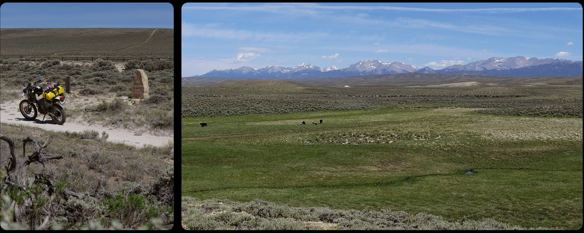
Not a lot has changed in the last 150 years. The pass is still very desolate, and it took me some time to find the original spot where the emigrants and their wagons had passed.
Two markers commemorate the trail here; one was placed by Ezra Meeker, who rode the trail himself in 1852 -and again in 1906 and 1910-, and one was erected for Narcissa Whitman and Eliza Spalding, the first white women to cross the pass.
The pass was discovered by Robert Stuart, who in 1812, with six others, was on his way from the trade settlement Astoria (near Portland, Oregon) to St Louis in the east. This discovery was of vital importance for the future Oregon Trail; suddenly it was possible to cross the Rocky Mountains with wagons, something that nobody had held possible before.
Although the South Pass looks somewhat insignificant, it still is part of the great water divide of the North American continent. All the oil and gas that leaks from my bike from now on, will eventually end up in the Pacific Ocean.
The first water the emigrants saw after crossing the divide was Pacific Springs, on the bottom of the right photo. A lot of overlanders camped at this spot, for the first time in Oregon Territory. They were now halfway on their journey and for many it meant an important psychological step; there really wasn’t a way back now.
After the South Pass there were two options: the emigrants could take the Sublette Cutoff, a route that would take them west in almost a straight line and which shortened the journey by a few days, or one took the southern way, to Fort Bridger. This last route was longer, but at least it meant that there would always be water available for people and oxen, due to a number of rivers that run through this barren land.
On the Sublette Cutoff, on the other hand, the emigrants had to cross a 50 mile stretch of land, through blazing hot desert, without even a drop of water to be found on the way. A lot of lives were lost here, especially oxen’s. Many years later emigrants still remembered the stench of rotting ox carcasses along the road.
From 1859 it was possible to take a third route: the Lander Cutoff, built by the American government. This trail went north of the Sublette Cutoff, but never really got very popular.
I decide to take the route to Fort Bridger, because like the South Pass, the route along the Sublette Cutoff has changed very little the last one and a half century; it still is extremely hot and very empty.