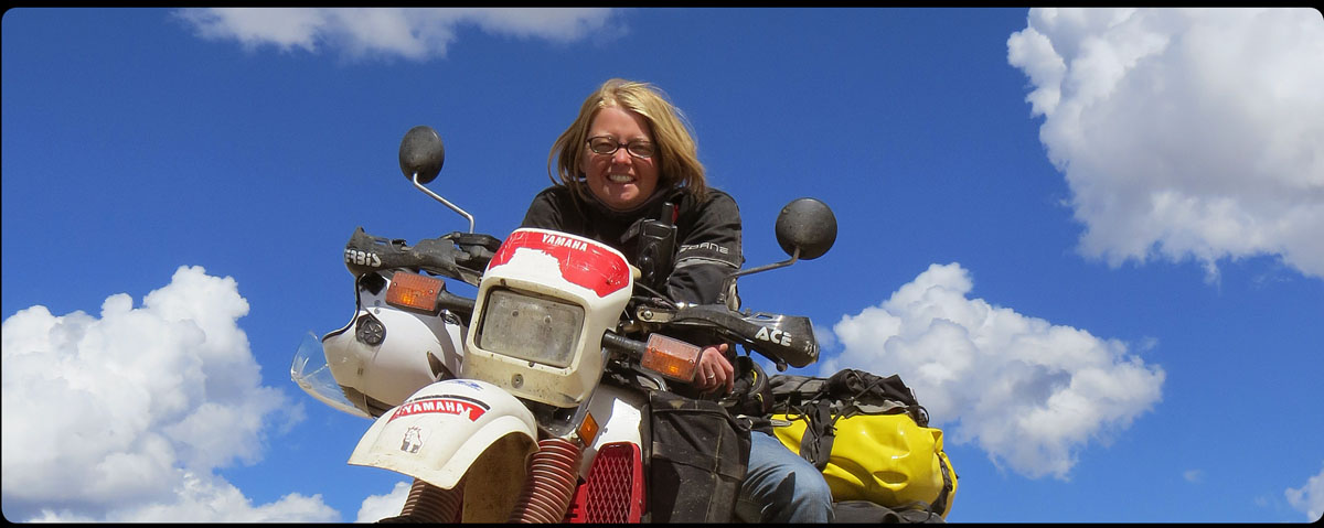
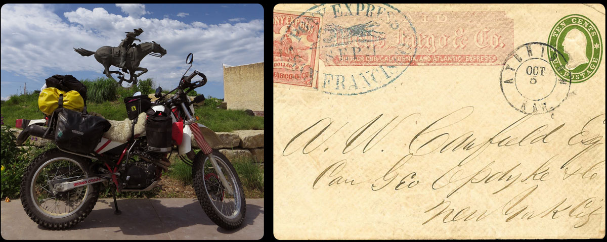
On the 5th of June 2013 I got on my motorcycle to ride the 2000 mile long Oregon Trail, the trail thousands of Americans took about 150 years ago, on their way to the far and unknown territory of Oregon. For me, it was relatively safe and easy to ride from Independence, Missouri to Portland, Oregon, but for these people it was incredibly courageous to start this trip that would often proof to be a life changing experience.
My own trip emerged from a desire to see more of this historic trail, and to see a part of the US that has always fascinated me. I wanted to relive the trail, as close to the original as possible, and on my favorite means of transportation: a motorcycle. I also intended this to be a test; would I be able to spend a month on the road alone? Across a stretch of land that was called ‘The Great American Desert’ in those days…?
If you want to know how I did, and how I experienced this trip, you can read all about it here.
It’s already been two weeks since, having reached the destination of my trip in Portland, I got on the bike and rode back to Boulder. After 1,200 miles in three hot and long days I’m back with Anne and everything that happened the past month has had a chance to settle.
If I had to summarize the trip, I would use words like ‘fantastic’, and ‘very worthwhile’; and that would be the truth. But the trip was a lot much more than that and it would be unfair if I left it at these few words.
It’s very hard to go on a journey unprejudiced. Whether you like it or not, ideas will form in your head about what you will see and find on your way, and although I did my best to suppress these ideas as much as I could, they annoyingly emerged in my head unannounced.
In my mind, I pictured myself trying in vain to fix a flat tire in the middle of the desert. Or I would imagine myself hitch-hiking, trying to get to the nearest motorcycle shop. And once I reached it, I would of course have to wait for a week in a crappy but way too expensive motel full of cockroaches for a new motorcycle part. I pictured myself stranded without gas in some desolate landscape, where I had to defend myself against rattlesnakes and other creeping scum. And in my darkest fantasy I was afraid I would be robbed of the bike and everything else, and end up stranded in a town full of rednecks, without money, phone or means of transportation.
It turned out that these thoughts were mainly fed by fear of the unknown, and it wasn’t, in any way, consistent with the truth. Gas was available almost everywhere, the people were extremely friendly and helpful, and I had no problems at all with the bike.
During the trip slowly but certainly it dawned on me that all problems eventually can be solved. This gave a comforting feeling, a certain calm, and instead of worrying of the things that might go wrong, I was able to enjoy everything around me more.
The idea for this trip originated from a desire to find the history of the hundreds of thousands emigrants that crossed the North American continent in the second half of the nineteenth century. Of course I had some preconceived ideas about this as well. It was obvious to me that I would relive in detail what these people saw and experienced, simply by traveling the same route to the West.
Unfortunately, many of the traces that I hoped to see had vanished in the course of time. The land through which I traveled is a modern land, and though it is proud of its heritage and indeed cherishes it, it’s also constantly developing itself. This has had a big impact on what’s left of the old Oregon Trail; in time trees were planted, prairie was cultivated, roads were constructed, and houses and plants were built.
One of the most typical examples of this ‘degradation’ of the trail was the grave of an emigrant, once situated on the vast and open plain, now in a field stripped bare, with an occasional yukka, unreachable because of the barbed wire fence from some ranch, and overlooking an ultramodern power plant. The land hasn’t stopped developing the past 150 years, something for which it cannot be blamed, but in many ways it didn’t improve how I experienced the history of the very same land.
The landscape may have changed in many ways by human intervention, the climate hasn’t. It can still get really hot in Nebraska, Wyoming, Idaho and the eastern part of Oregon, and though the roads have improved drastically, it still is very dusty in these parts, the wind still blows as hard as ever, and never will a thunderstorm let itself be chased away by human beings. This definitely gave me a good idea of the conditions the emigrants had to travel in.
Of course the distances in this enormous country haven’t changed either, and so it happened more than once that, while I was riding at a comfortable speed of about 55 miles per hour on some very good asphalt road through the dry land, I realized that the distance I covered in one hour, was a distance the emigrants would need three days to overcome. And after riding a few hours through the summer heat, a cool store next to a gas station where I could buy just about everything I needed that day would await me, a luxury these people never had.
I expected the landscape to be more diverse, more spectacular, maybe. But how did I ever think I was able to ride impressive passes, with some really beautiful winding roads, enough to make any motorcycle rider drool, on a route where always the flattest and most accessible road was chosen? For the emigrants the going was tough enough as it was. These people weren’t interested in some spectacular tourist landscape, all they wanted on a day was to cover enough distance. A miscalculation on my side, which does not alter the fact that I saw some really beautiful things on my route.
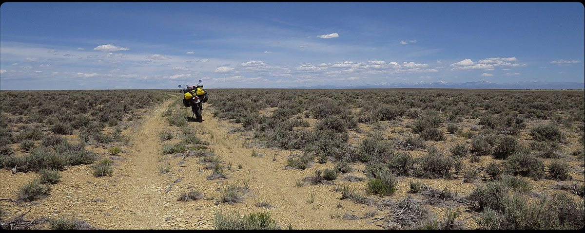
Then there was the much feared off-road challenges I expected to face. When I was planning my route on maps and on the internet, it was hard for me to know what awaited me. You can’t see the condition of the road from above, and on a map it is impossible to see how much rain fell the previous days. Sometimes a clear warning about impassable roads was given in one of the guides I read, or they advised people to stay away from a road at a certain time of year. But generally, I was on my own in guessing the conditions of the route. It turned out that most of the gravel roads in the US are very well maintained, some better than others, and with some practice I was able to ride well on all of them. They brought me to some very beautiful places, and I have the best memories of the rugged and empty land I saw here. Only once did I work myself into trouble when a road that looked like a good road on the map, slowly changed into a sandy cow trail.
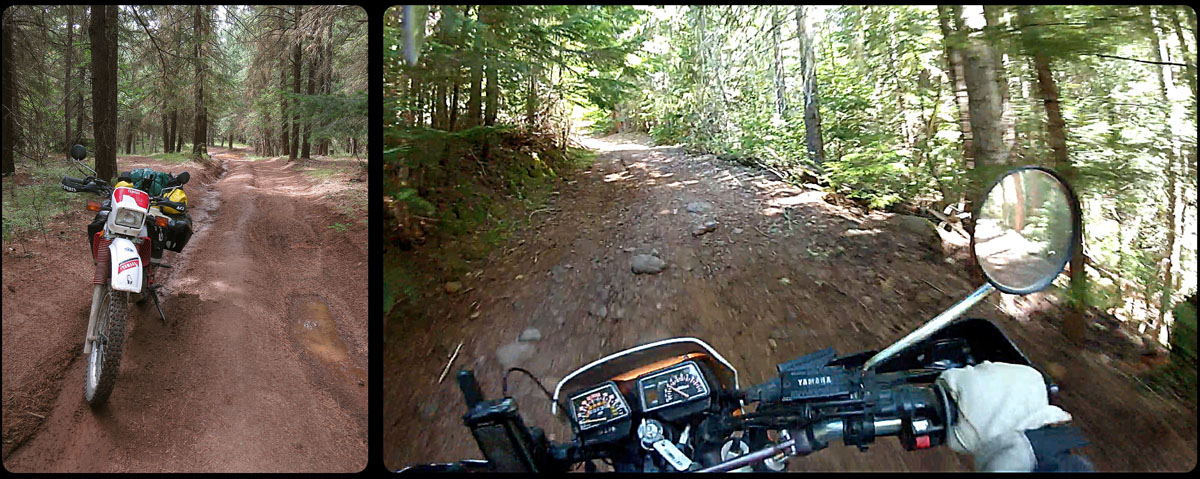
And then there was the old Barlow Road in Oregon that was in a condition not much better than how the emigrants had left it. This formed one of the more serious challenges for me. The biggest part of the road I rode without much problems, but the last stretch through the woods of Mount Hood, however, got too technical for me, and for safety reasons (alone, nobody around for miles, too heavy motorcycle, too attached to expensive equipment like computer and camera) I decided to skip it. It was a hard decision to make, and it felt a bit like defeat, but it probably was the best thing to do (or so I like to tell myself).
With the people, of whom a land eventually really consists, I had nothing but positive experiences. Numerous persons asked me where I came from, where I was going and showed genuine interest. They were impressed by my intention and my trip. They helped me when I needed something, went through a lot of trouble to give me sound advice, and sincerely wished me well and told me to be careful out there on the road. Nobody who told me I was insane, only people who admitted they didn’t dare to undertake such a trip themselves. Some of them confessed that they had always wanted to go and travel, and I always encouraged them to do so.
I think that in the spirit of the Americans in the West, quite a bit of determination of the emigrants is still left, and not much has changed in that sense for the last 150 years; a lot of people still travel the entire country, searching for a place that’s better, more beautiful or safer, whether it is for work or for pleasure. Of all the people I talked to, only one or two still lived in the town they grew up in, but these really were exceptions. It is in the genes of Americans to travel, and in many ways I think they are still a nomadic people.
All these elements made this trip for what it was: searching for and experiencing history, meeting people, facing challenges and trying to overcome them, and mostly: enjoying the beautiful things you see on the way, whether they are expected or not.
I set myself a challenge, and I succeeded in what I wanted to reach. This gives me a sense of accomplishment, and also some pride. It makes me feel stronger in what I am and more confident in reaching the next goals I set for myself.
Living without luxury or familiar company for a month makes you realize what you have, and that these things are invaluable; friends that support you in what you do, good health, but most important of all: a home to return to.
I did it, 3,671 miles on my sturdy little bike: I made it to the end of the trail.
It’s been a great experience, and although the things I did were not in any way spectacular or even ground-breaking, for me it was well worth the effort.
Thanks to everyone who helped me realize this project, and thanks for all the positive and stimulating reactions that I got along the way!
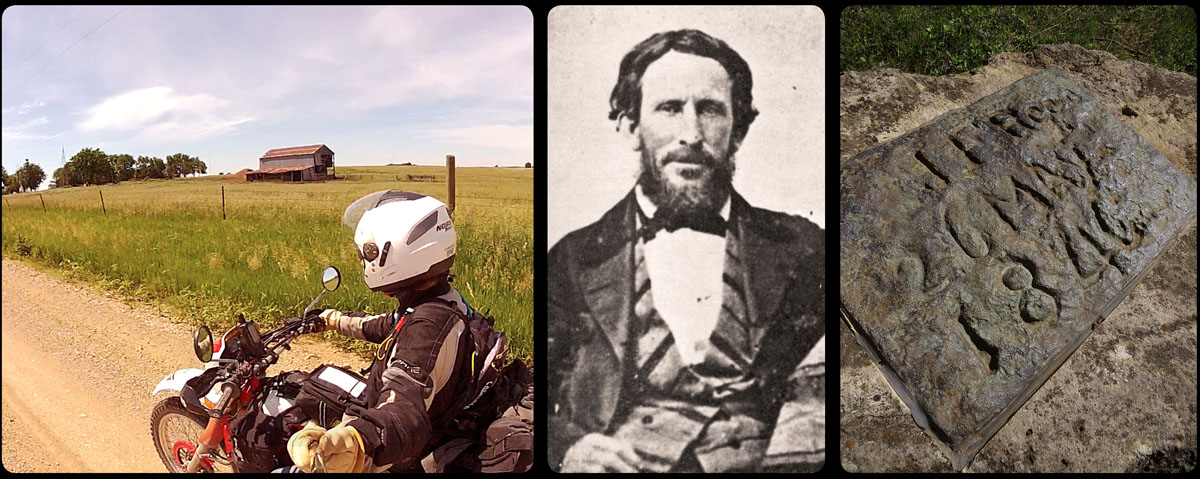
In the autumn of 1845 Sam Barlow is overseeing the small harbor in the inlet of the Chenoweth Creek, near present day The Dalles, and he looks at all the work that’s being done by the emigrants that are building rafts for their trip on the river. Wheels are removed from the wagons and placed under the wooden body, which is to become the shelter on the rafts for the rest of the trip. Most of the livestock is sold so the emigrants are able to pay the ferrymen.
Sam Barlow though, has other plans. He wants to find a road over land, south of Mount Hood, straight through the thick forest. Sam has heard enough stories of people drowning in the strong currents of the Columbia River. That’s is not going to happen to his family. Apart from that, he is outraged about the high prices the ferrymen are asking to get the emigrants to their destination.
It’s October by now, and winter is drawing near with frost and rain, not something the tired and weakened travelers are looking forward to. But they have no choice now but to move on. After a few days, the company of Joel Palmer joins Barlow’s and together they start building the road.
The two men don’t get the huge job done before winter falls. Still on route, they decide to make a cache where they will leave their belongings, and one volunteer, William Berry, is left behind to stay the winter and guard everything. The others load their most needed things on the draft animals and start off to Oregon City on foot. Next spring, Barlow and Palmer return with more men to finish the job. Berry is found in good health, their possesions are still intact, and they start building right away.
This all sounds as if the road that was built was comfortable and safe but, unfortunately for the emigrants, this was not the case. It was still very rugged and so was the terrain, with all the dangers that come with it.
The trail, because that was all it really was, hasn’t changed very much in all these years. Where in other places the Oregon Trail has been paved with tarmac, today large stretches of this road have hardly changed in 150 years’ time. And that it was a rugged road, I now know from personal experience.
In the spring and summer of 1846 the road was finished, and from the autumn of that same year, emigrants could choose whether they wanted to travel over land or by water. But if they wanted to continue their journey south of Mount Hood, they’d have to pay Sam Barlow, the man who was so outraged about the financial exploitation of the emigrants, toll to travel this road.
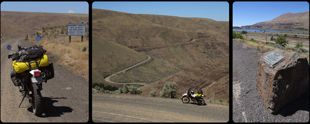
On the gravel road, on the steepest part of a climb, a car is coming from the opposite direction. The shining black machine slows down and comes to a stop right next to the bike. A tinted window slides open and the head of a young woman of about thirty years old appears.
‘Who are you?’ she asks in a resolute way. I’m a little perplexed by this strange question.
‘Uh…why do you want to know?’
‘Because you are on private land’
Oh shoot, here we go again. Every time I think a found a nice off road, I’m not allowed to ride it. Normally I’d see three or four ‘no trespassing’ signs (with bullet holes, to emphasize the intention) but this time I didn’t see any at all.
I apologize, and the woman helps me find an alternative. I can either go back to the highway, or take another, but a longer, route. She shows me how to find it, but I can’t see any road where she puts her finger on the map. Still, she seems very certain about it and it is obvious that she lives around here; I just got kicked off her land. It looks like she really knows what she’s saying. Besides, only a wimp would turn back to the highway.
Not long after I take this new route, there is a sign next to the road, that says; ‘WARNING – DANGER next 3.4 miles 6% down grade’. This makes me doubt my earlier decision for a moment, but I really don’t feel like riding this whole way back.
The gravel on the road down is very deep, probably because of all the trucks braking at this point. And the deep gravel is only alternated with even deeper gravel. I gear down as much as possible, but it’s not enough to slow the bike down; I have to use my brakes as well. Several times, I think I can feel the front wheel slide a little.
It’s only on the less steep parts that I have the courage to take a few pictures. And after every photo session, I hope I can kick the bike back to life again, I don’t want to get stuck in these lifeless and hot surroundings. Fortunately I’m on a pretty steep grade.
About half an hour later, I’m back on the trusted ‘blacktop’, and in the town of Biggs (population in 2010: twenty-two) I finally leave the steaming hot canyon, straight to the Columbia River. I’m trying to find ‘First View Monument’, a reminder of the fact that on this spot the emigrants saw, for the very first time, the mighty Columbia River, the river that would take them to their destination: Willamette Valley.
I ask a waitress where the monument is, but all I get is an empty stare. ‘I’ve lived here for twenty years, but I’ve never heard of such a monument!’ she exclaims. One mile down the road I find the stone marker.
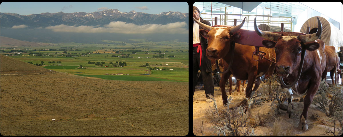
East of Baker City lies the Oregon Trail Interpretive Center, built right where the Oregon Trail once passed. When they reached this point, the emigrants had left the hot and dry Hells Canyon, and were slowly moving towards the Blue Mountains, a final hurdle that had to be taken before they reached the Columbia River. It must have been both a magnificent and frightening sight to see.
Today the snowy peaks of the Elkhorn Ridge still look the same as 150 years ago. From the museum, situated on a large hill, I took a picture of the ridge. The little white dot on the left is a full-size ‘prairie schooner’, a wagon like the ones the emigrants traveled in. It gives a pretty good idea about the size of this country, and how small and insignificant the people were that crossed it.
The valley through which the Powder River runs is colored green by potato, beet, onion and corn. Cows and horses feed themselves on the rich grass. Just like it must have been for the travelers to Oregon, this fertile land is a welcome change for me from the grey and brown hills covered with sagebrush.
By now, I begin to notice that I’m starting to get a little travel-weary. I’m not as surprised anymore at the things I see, and I am not as eager to have a conversation with people I meet along the way.
Just this afternoon, at a gas station, a man told me about his motorcycle crash with some huge bird of prey. It cost him a part of his arm. A thrilling story, and a few weeks ago I would have hung on his lips. Now, all I really want him to do is go. I want to ride, move on, focused only on my goal of reaching the end of the trail.
I can imagine that it must have been the same for the emigrants. By now, there was no way back, but there was still a very long way ahead, and they knew it. They were tired of traveling but had no choice but to move on.
Today, I traveled a distance in a few hours that would have taken the emigrants, in this mountainous region, about ten days. The longer I am on the road, the more admiration -or should I say wonder- I feel for the people that made this incredible journey.
Tomorrow I hope to reach the Columbia River. Nearly there.
The past few days I have followed the Snake River as closely as possible. The impressive river now calmly finds its way through Idaho and Oregon, but in the days of the trail it formed a serious barrier for the emigrants. Today the river has been dammed in many places, but halfway the nineteenth century it was a wild and dangerous waterway. Twice, the overlanders had to try to get their belongings across, once at Glenn’s Ferry, and once at the old Fort Boise, in present-day Idaho. Some decided it was better to keep following the river on the south side, but that meant traveling many miles further.
Still, following the river was no guarantee that there would always be drinking water. A lot of times the river water was far below the high plateau the emigrants crossed. That made it very hard, if not impossible, to reach the water. While traversing the hot and dry plain, with hardly enough grass for the animals, the emigrants could hear the river roar down below, unreachable for thirsty people and draft animals.
The name of the river is derived from the Indians in this area: the Shoshone, often called ‘Snake’ by the emigrants, probably because they made snake-like motions of the hands in sign language. The Shoshone, as their befriended tribe the Bannock, were very good fishermen, which the emigrants benefited from: salmon was a very welcome change of diet after months of bacon and beans.
Although the first encounters with Shoshone and Bannock were friendly, it wouldn’t take long before the relations between the Indians and the whites turned sour. In the eyes of the emigrants these people were inferior, especially when they were too poor to own horses, and consequently, they were treated disrespectfully. But they were excellent horse thieves, and more than once a surprised emigrant would count fewer horses in the morning than before he went to bed.
This photo was taken near Shoshone Falls, or Twin Falls, hardly ever visited by the emigrants because the trail wouldn’t pass here. Nevertheless, this ‘Niagara of the West’ was often mentioned in diaries; the loud roar of the falls was clearly audible on the trail, about 8 miles to the south. Not a lot of emigrants would actually hike out to see it, because going there would put you in serious risk of loosing your scalp.
Today I rode through the Fort Hall Indian Reservation, north of Soda Springs, Idaho, where the Oregon Trail used to go. I was unsure if I was allowed to ride here at all. I knew that in some reservations non-residents are not allowed to enter. Yesterday, I tried to gain some information about it at the Ranger Station in Soda Springs, but unfortunately that was closed on Sunday. Subsequently, I bothered several complete strangers about it. They were all very friendly, and they all told me that it should not be a problem. It was enough to convince me to go. Besides, I was wearing my ‘scalp-protector’, and should things really go wrong; I would also have two mirrors on my bike.
The area north of Soda Springs is very green, thanks to the Pontneuf River that runs through the wide valley. I saw grassland, flowers and numerous birds everywhere. Farmers were busy harvesting the hay, which was pressed into enormous green sugar cubes by an impressive-looking machine. Afterwards they were spat out onto the cropped meadow. Behind this ‘sugar cube-pressing machine’ dozens of gulls were flying, as if they were hovering above a fishing boat on the sea. It was a strange sight to see, on these green meadows of Idaho.
I didn’t see any Indians today, except one in a Fort Hall Indian Reservation car. It was probably some kind of tribal ranger, who keeps an eye on everything because trespassing is not allowed here.
I meant to stop and have a chat, but at that very moment, all my attention was focused on the road that had turned into what seemed to be a river bed covered with fist-sized boulders. As I passed by, the ‘ranger’ raised his hand to greet me (Indian humor?) and I returned his greeting enthusiastically, an impulsive reaction that nearly cost me dearly; the bike started swaying like a fish fresh out of the water. Better keep both hands on the handlebars, just like my mother told me.
Before the emigrants left home, they had heard and read numerous stories about these ‘bloodthirsty’ Indians, stories that were exaggerated further by the press. So imagine the surprise of travelers to Oregon and California when they discovered that the Indians they met were actually very friendly. Often they would trade: emigrants would receive animal skins, moccasins, or meat; in return they would give things like knives, needles, tobacco, blankets or clothes.
Until the eighteen-sixties there were very little skirmishes between white people and Indians. Sometimes cattle of overlanders was stolen or a group of Indians would invite themselves along a wagon train for a few days, something that might cause some irritation among the emigrants, especially since the wide robes the Indians wore could hide a lot of cutlery.
White men, however, would shoot the game the Indians had to live off and the cattle of the overlanders would graze the same grass the buffalo needed as well.
From about 1845 on, the white men would travel west by the thousands, and the Indians started to realize that their way of life was seriously threatened; the buffalo were being exterminated and the many treaties made with the Indian tribes were not respected by the whites. The Indians slowly lost their patience, something that would eventually result in the Indian Wars, when Indians tried to resist the whites on a much larger scale. And if history had turned out just a little different, I would probably have ridden through the Fort Hall Emigrant Reservation today.
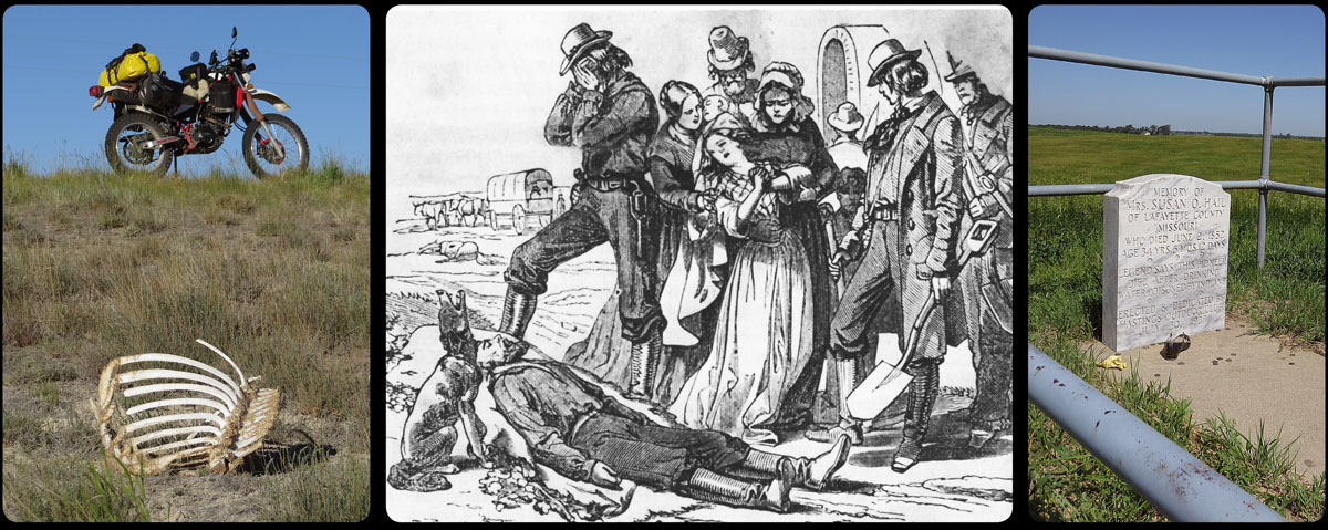
To see the American wildlife, you really don’t need to leave the highway. Many victims of traffic are lying next to the road; skunks, raccoons, deer, antelope, rabbits, prairie dogs, squirrels, swallows. This morning I even saw a small lynx on the tarmac. Sometimes bones are all that remains of the victim.
In the five months on the road, there would be many deadly victims among the emigrants too. And contrary to popular belief, it weren’t the Indians that caused the most deaths. This dubious honor fell to cholera, or Asiatic Cholera, to be precise. The symptoms of this disease were diarrhoea and vomiting, and those who were infected were usually dead not long after they began to feel ill. It was possible for someone to be perfectly healthy in de morning, and buried at the end of the very same day. Bad hygiene in the popular and crowded camping spots were the causes of the rapid spread of the disease, especially in the infamous years 1849, 1850 and 1851, along the Platte River route. Here the disease made thousands of victims.
Everybody was afraid of the ‘invisible death’. Some of the sick were left behind, a note attached to their clothes, asking other travelers to give them some food and water. There are even stories of people that were buried before they were actually dead.
Not everybody was that harsh; there was al lot of compassion on the trail too. Plenty of stories exist of people that took care of or buried strangers, of the sick that were hoisted in a wagon passing by, or of orphans that were taken in by other families, supported from a ration that wasn’t all that much to start with.
Coffins weren’t available, of course. Sometimes boards of the wagon were used, in other cases the dead were just wrapped in a blanket or buffalo hide.
The deceased were usually buried right on the trail. That way, the graves were soon trampled by oxen and wagons, which reduced the chance of graves being looted by wolves or Indians. Every mile of the trail is said to contain as much as fifteen graves. The world’s longest burial ground, it is often called.
Whether it was death by cholera, or by an accident, by stampeded cattle, by drowning, or an attack from Indians, people never really got the time to process the loss of their beloved ones. They had to move on, making enough miles, making sure they had enough food every day. That was what mattered, if they wanted to arrive safely in Oregon eventually.
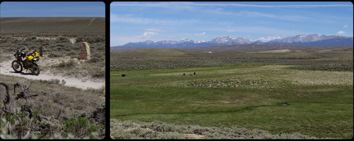
What a terrible disappointment it was for many of the emigrants: South Pass. This was the way to cross the Great Divide, the only passable route over the Rocky Mountains. High and spectacular mountains is what they had expected, a very narrow trail to be traveled, just wide enough for the wagons, with a ravine on one side, where far below a wild river, barely audible, was making its way over the rocky river bed.
Instead they saw a gently sloping mountain, completely covered with sagebrush. The only snowy mountains they saw were on the horizon, many miles to the north.
Not a lot has changed in the last 150 years. The pass is still very desolate, and it took me some time to find the original spot where the emigrants and their wagons had passed.
Two markers commemorate the trail here; one was placed by Ezra Meeker, who rode the trail himself in 1852 -and again in 1906 and 1910-, and one was erected for Narcissa Whitman and Eliza Spalding, the first white women to cross the pass.
The pass was discovered by Robert Stuart, who in 1812, with six others, was on his way from the trade settlement Astoria (near Portland, Oregon) to St Louis in the east. This discovery was of vital importance for the future Oregon Trail; suddenly it was possible to cross the Rocky Mountains with wagons, something that nobody had held possible before.
Although the South Pass looks somewhat insignificant, it still is part of the great water divide of the North American continent. All the oil and gas that leaks from my bike from now on, will eventually end up in the Pacific Ocean.
The first water the emigrants saw after crossing the divide was Pacific Springs, on the bottom of the right photo. A lot of overlanders camped at this spot, for the first time in Oregon Territory. They were now halfway on their journey and for many it meant an important psychological step; there really wasn’t a way back now.
After the South Pass there were two options: the emigrants could take the Sublette Cutoff, a route that would take them west in almost a straight line and which shortened the journey by a few days, or one took the southern way, to Fort Bridger. This last route was longer, but at least it meant that there would always be water available for people and oxen, due to a number of rivers that run through this barren land.
On the Sublette Cutoff, on the other hand, the emigrants had to cross a 50 mile stretch of land, through blazing hot desert, without even a drop of water to be found on the way. A lot of lives were lost here, especially oxen’s. Many years later emigrants still remembered the stench of rotting ox carcasses along the road.
From 1859 it was possible to take a third route: the Lander Cutoff, built by the American government. This trail went north of the Sublette Cutoff, but never really got very popular.
I decide to take the route to Fort Bridger, because like the South Pass, the route along the Sublette Cutoff has changed very little the last one and a half century; it still is extremely hot and very empty.
This morning, when I tried to find the Poison Spider Road from the campground in Casper, all I found was a ‘closed road’ sign. Maintenance was being done on the road. It looked so promising on the map; a small, winding road, -exactly- along the old Oregon Trail, that I would have been able to follow for miles. Alas, no such luck today. I decided to go to Bessemer, a town a little south of Casper, and from what I could see on the map, it should be possible to access the Poison Spider Road from there.
Unfortunately, that wasn’t going to happen either. Two road workers who were installing a road sign informed me that the road was closed because it was being magged. That means it’s being treated with magnesium chloride to make it less dusty in the summer. According to the men, I really didn’t want to ride my bike in that stuff.
So back to the highway it was. With gritted teeth I had to watch the red cliff on my right slowly pass by. I would really have loved to see more of that.
After a long and boring ride on the highway, being swung back and forth by the strong wind, I made a second attempt. No closed roads here, this time it was going to work.
I made a right turn on the highway, and immediately I was on a gravel road. It was obviously being used a lot; the bike and me were shaken to pieces because of miles of washboard road. The steering felt terrible, I was afraid that either I had a flat tire, or my headset bearing was completely ruined. But then the surface was getting a lot smoother and I was able to ride a little faster again. The steering, fortunately, was a lot better now too.
The landscape was beautiful here, but I don’t think it can get more remote than this. I was riding through a desert-like plain, with some serious looking mountains of red clay on the horizon. Every now and then a pronghorn, grazing unsuspectingly between the sagebrush, jumped away, terrified.
Half an hour later, I rode onto the grounds of what seemed to be a ranch. There were few decaying sheds, trucks parked everywhere, but there was nobody to be seen. I knocked on the door of the house – better ask if I’m allowed to ride on their property- but there hadn’t been anybody in there for a long time. The floor was missing and there was junk everywhere.
I went back to the bike, but when I tried to continue on the road, past the clumsily-made bridge, I saw that it ended here.
Great. Back to highway again. For many miles, the only dark cloud in an otherwise sunny Wyoming was right above a small red dirt bike that was slowly making its way on the highway.
Around noon, it was time for the third attempt. The Hudson – Atlantic City Road. There was a big sign at the beginning of the road that said this road really was going somewhere; so that was good.
Anything gravel that was denied to me earlier, was made up here. The landscape was not exceptional, but it was fascinatingly empty. Sometimes I felt I was riding across Mongolia. Black cows and their calves were grazing between the sagebrush. Sometimes they were in the middle of the road, so I carefully had to pass them. On the horizon the first signs of the Rocky Mountains were showing; the Wind River Range is slowly moving closer. So much to see on this perfect afternoon.
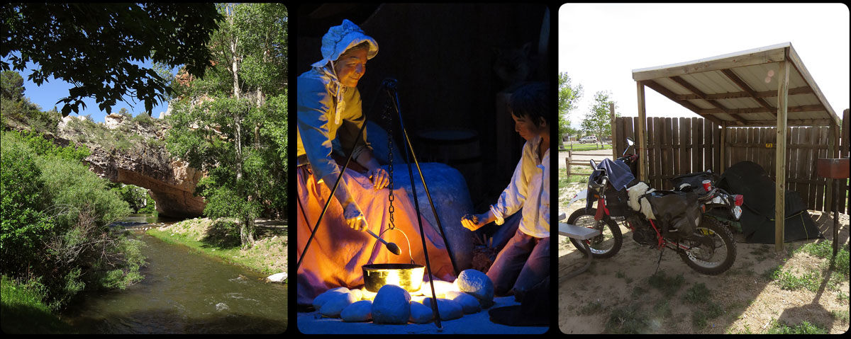
Halfway the nineteenth century, the camping spot at Ayers Natural Bridge, carved out by the LaPrele Creek, was a beautiful spot, with clear water and shelter provided by many trees. Understandably, emigrants loved to camp here. Today it still is a lovely place. There is a campground now, where you can put up your tent on patches of soft grass, sheltered from the sun by trees and high cliffs. A small green oasis in the rough and bone-dry Wyoming land.
For the emigrants it wasn’t easy to find a suitable place to make camp every day. There had to be grass for the animals, wood to make a fire to cook on, and of course water, preferably of potable quality.
Where to stay every night on the long journey was explained in the many guidebooks that where printed for the emigrants. Unfortunately, the information in these books was often outdated by the time it reached the overlanders; it was possible that one year, because of many storms, there was plenty of water to be found at a certain spot, but in later years weary travelers would find only a dry river bed.
Finding a suitable camping spot wouldn’t just be the end of it. Wood had to be gathered, or, if this wasn’t available, so called buffalo chips (dried buffalo dung), nicknamed ‘bois de vache’. Camp had to be made, maybe some tents had to be put up. Somebody was charged with the task of collecting water, and the draft animals had to be looked after. Any broken, wagons or the gear of mules or oxen had to be repaired, and of course, a meal had to be prepared. This meant making dough, baking, preparing bacon and beans and making coffee (coffee beans first had to be roasted in a frying pan and subsequently ground).
If the weather was bad and they just couldn’t get the fire going, supper for the emigrants was limited to so called hardtack; extremely hard biscuits, supplemented maybe with some dried fruit or pickles.
And at the end of a long day, if the emigrants weren’t dead tired by then, there was time for some entertainment; music was made, usually accompanied by singing. Very often these late hours of the day were used by people to write their journals. It is amazing that so many kept this up faithfully for all these months.
My own camp for tonight unfortunately isn’t so heavenly as the one on the LaPrele Creek. I’m camped a little north of the town of Casper, on a sandy spot covered with weeds, which possibly once was a patch of grass.
There’s a very strong wind blowing that, accompanied by a temperature of about 95 degrees, feels like the air out of a warm hairdryer. As if to emphasize the harsh conditions, every now and then some tumbleweed comes rolling by.
I was allowed to put up my tent under a specially built wooden tent shelter, which is a good thing, otherwise I would probably have had to pick up it somewhere in Montana.
It’s hot, dry and windy. Welcome to Wyoming.
‘.. Brought us in view of the post of the American Fur Company, called Fort John, or Laramie…It is on the left bank, on a rising ground some twenty-five feet above the water; and its lofty walls, whitewashed and picketed, with the large bastions at the angles, gave it quite an imposing appearance…’ These are the words of John C. Fremont, one of the most important explorers of the American West.
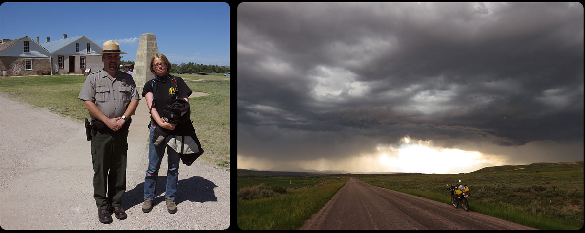
Yesterday I paid a visit to this fort. First called Fort William, then Fort John and finally Fort Laramie, it was built on a strategically chosen point on the Laramie River in Wyoming, just before it joines the Platte River.
Originally built in 1834 as a trading post, where Indians could trade furs for blankets, knives, food and liquor with white traders,in later years the fort became very important as a military and supply post in the Indian Wars.
In the days of the Oregon Trail it was an important resting place. It was estimated that in 1847 between four and five thousand emigrants visited the fort. Quite a lot, if you consider that the only right time to travel was a few weeks in early summer. The travelers could fill up on supplies, repair the wagons in the blacksmith’s shop, send mail to family and friends, ask advice about the condition of the road ahead and trade goods with the Indians that were camped around the fort.
Before the emigrants went back on the road, they bought a lot of supplies. They didn’t realize, however, that they were about to cross the Black Hills. Very soon it became clear how ignorant they were, bringing along so much extra weight in their wagons. They tried to sell most of the goods, but everybody had the same problem, so a lot of supplies were simply dumped by the side of the road.
An emigrant on his way to the California gold mines wrote in 1849: ‘We begin to see the preparations made by the overloaded trains for crossing the Black Hills – piles of bacon lying by the roadside, some must have 2000 or more lbs, beans -corn – all kinds of iron implements & cook-stoves etc -etc- One train we passed told us they threw away over a ton of bacon – several barrels of bread – six dozen steel shovels – axes, hoes, etc – etc – amounting in value to nearly 1500 dollars.’
I crossed the Black Hills too, but I took a more southern route than the original trail. Because of my extended visit to Fort Laramie I was somewhat behind on my 90 miles-per-day schedule so I decided to take a faster road instead of the planned dirt road.
It was frustrating to see that the road I chose as an alternative -which on the map seemed to be a nicely paved road- suddenly changed into a gravel road. To add some excitement to the day, I rode right into a very dark sky that dumped its wet content on me not long after.
Despite all this I didn’t regret not choosing the even faster route by highway. The rain didn’t last very long, and this area really looked like paradise. The dirt road took me along lush green hills full of flowers. I even met a few pronghorn, and I saw two white tail deer run away into the fields.
I felt alive and enjoyed everything around me, even the dark blue storm clouds on the horizon that couldn’t seem to decide which way to go.
At some point the dirt road started to get very rough. To my own surprise I managed to get through this plowed field of stones (that’s what it resembled most) intact, and not long after that, the road was once again covered with gravel and I could make a few miles.
One hour later I was sitting in the sunshine on a campground in Douglas, tired but satisfied. Just another boring day at the office…
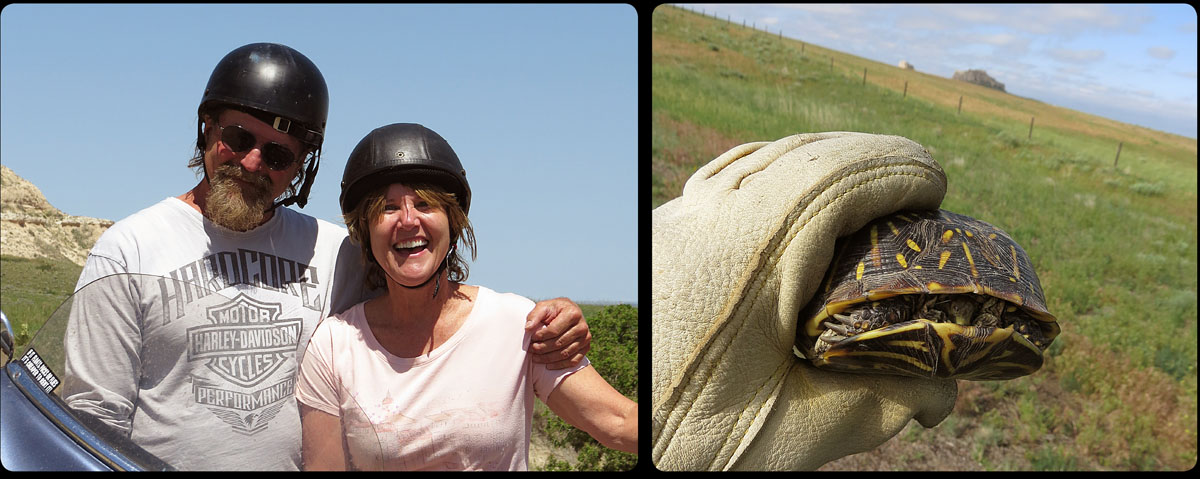
Last weekend Anne came to visit me in Nebraska. We spent two relaxing days together on a campground near Scottsbluff, on Lake Minatara. We fixed some minor things on the bikes, did some laundry, and mostly nothing but enjoy the sun and each other’s company.
But today it was time to get back in the saddle. I really had to get used to being alone again. Not because I’m lonely or I’m not having a good time. I enjoy riding every day, I meet so many warm-hearted people on this trip, like this couple from Iowa, and every day I see the most amazing things (a turtle, on the road, in the middle of the Nebraska desert..?)
The hard part was to leave my comfort zone again, letting go of the safe and familiar and dive into the great unknown. Leaving the certainties in life and be open to new experiences. And these may not always be what I would expect, but thankfully they always turn out to be worthwhile.
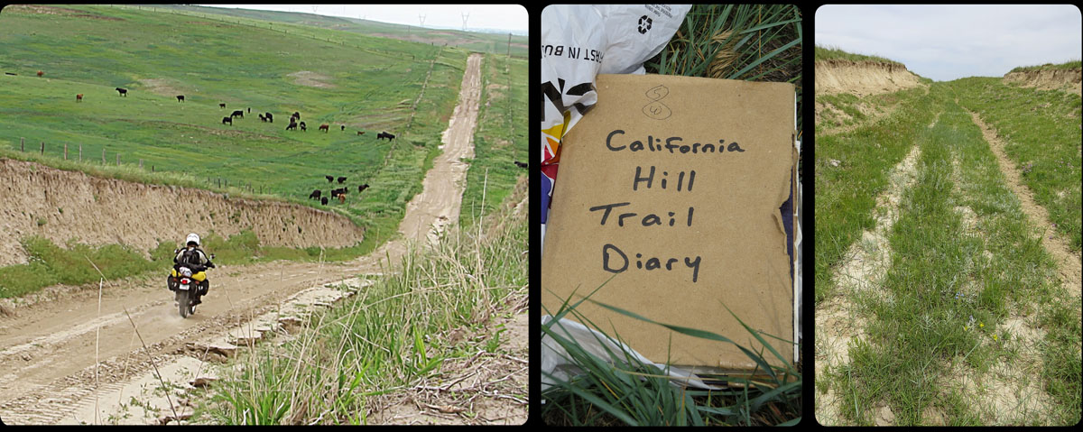
Right around this time, halfway in June, the emigrants reached the point where they had to cross the South Platte. They did this at the present town of Brule. The hill they had to climb was named after the crossing: California Hill. After about a month of traveling across fairly level ground, 450 miles from where they left Independence, they faced the first geological hurdle.
In the heat of the day I started my search for the ruts of the wagons that should still be here somewhere on the hills. Right after the historical marker along the highway, I found the dirt road that should take me there (‘minimum maintenance’, this could be fun). The further I rode , the deeper the holes got. As far as my guts allowed, I looked around, trying to find the entrance in the barbed wire fence.
‘It should have an old mailbox’, the campground manager had explained to me. For a few miles I rode the dirt road, but no mailbox. From up on the hills, cows where staring at me while I searched the pastures.
Back it went, down the road. ‘Could this be it?, I wondered, as I stopped and looked back. ‘This road through the hills?’ A drop of sweat ran from under my helmet, into my neck.
I saw a truck coming my way. I raised my hand to the driver, a young man somewhere in his thirties, deep tan, rough beard, and of course a baseball cap, because this is Nebraska, after all.
‘Wagon ruts? No, they are along highway 30. Ride this dirt road to the end, to the 30, and then you’ll find it on the north of 30. There’s a sign where the entrance is, you can see it from the road. You can’t miss it’.
You can’t miss it. Will I ever learn to mistrust people who say that? After riding the 30 to and fro for about 5 miles, I was right back where I started about an hour ago; next to the historical marker. But still no ruts.
I decided to do what I should have done an hour ago but what I’d stubbornly been postponing: I dug up Julie Fanselow’s guide from my pack. Following her clear instructions, it took me about five minutes to find the entrance in the fence. In the mailbox I found a small book, wrapped in a plastic bag, with names of people who were here before me. It felt like finding an old treasure.
I had to walk into the field to find the actual ruts, but not far from where I parked the bike I found them; 150 years old and still visible. The first real evidence of the trail on my trip, and it really touched me. This is where these people walked, with everything they owned; their children, livestock, food, and as much furniture as would fit in the wagon.
I looked around at the landscape. I felt the same wind that blew here 150 years ago, blowing along the same hills that are covered with the same grass and flowers. The only thing that has changed since the days of the trail are the cows grazing here now and who are watching me, probably wondering why I would possibly want to be photographing their food.
For two days in a row now I’ve been following the Platte River, or Kíckatus in Pawnee language. The emigrants stumbled upon the river on their way to the north, and they would keep following it well into Wyoming: the Mormons on the north side, most of the rest of the emigrants on the south bank.
The Platte (from French ‘platte’, or flat) is indeed a very shallow river. ‘A mile wide and an inch deep’, is how one emigrant described it. Another traveler wrote that it is ‘too thick to drink, and too thin to plow’. Somebody reported that the Platte was so sandy that it seemed like the river was flowing upside down.
At the town of North Platte it looks as if the river splits, but actually the North and South Platte join here; indeed the river flows to the east. I keep following the trail to the west, along the southern branch; the South Platte.
Today the river isn’t as impressive as it used to be. Gregory Franzwa, who made an elaborate study of the trail, wrote: ‘One is not able to see a damned thing because of today’s abundance of cottonwoods and the scarceness of water in the South Platte’.
For me it is the same as it was for Franzwa in 1972; I hardly see anything of the river, there always seems to be a green wall standing between myself and the river. In the days of the emigrants the banks were empty and devoid of trees. Only on the many islands anything other than grass would grow. The Indians were in the habit of setting fire to the prairie every once in a while. That would keep the vegetation low and made it easier for them to hunt game.
And there were the bison who lived in enormous herds on the prairie. They used to drink at the Platte and in the process crushed anything that was trying to grow on the banks.
The river was very shallow, but it was not without danger to cross it with these heavily loaded wagons; in the sandy bottom of the river, treacherous spots of quicksand would appear. If the draft animals would stop, or even hesitate, the wagon wheels would unrelentingly sink into the sand.
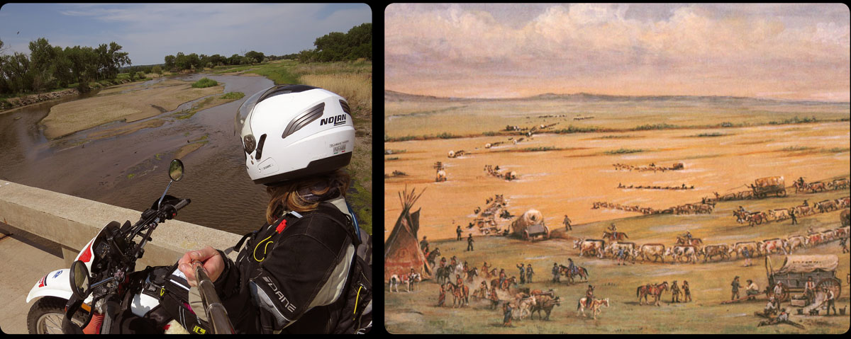
The painter William Henry Jackson made a painting of the crossing from a sketch he made in 1866, and on this painting the river is certainly a lot more impressive than the wimpy stream I got to see every now and then.
Today California Hill and Windlass Hill: the first two serious challenges for the emigrants and their oxen.
Yesterday the long and straight roads of Nebraska gave me plenty of opportunity to think about this trip.
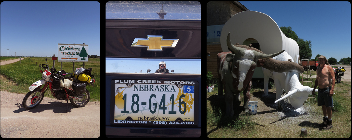
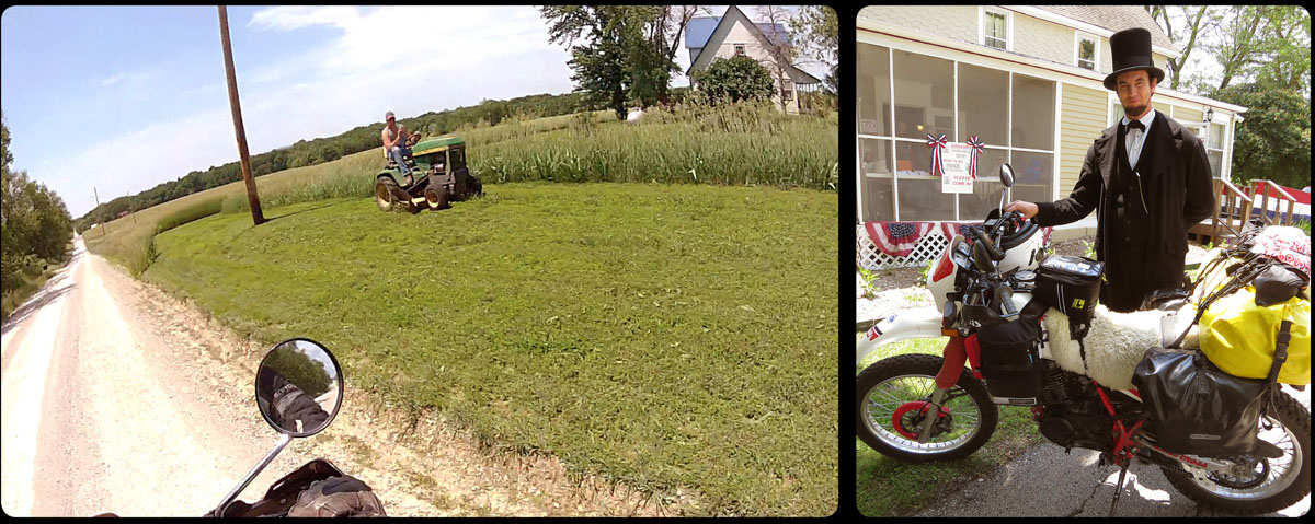
I wanted to relive the Oregon Trail; ride where people traveled more than 150 years ago and try to see the land through their eyes. Now, a few days on the road, I noticed that it’s the people I meet on the way that make this trip interesting. Abraham Lincoln next to my bike, the people of Gardner that organise an expo on the Civil War, casual encounters on the campground. Or yesterday morning, when somebody bought a new blade for his cordless electrical saw, just because I needed to cut a piece of steel. Or the guy I talk to who has a sign on his front lawn that says ‘Fries’ and it turns out he has Dutch ancestors. Or James, whom I meet in Odessa, and who is restoring a huge concrete sculpture of two oxen in front of an enormous covered wagon. It’s these people that make this trip worthwhile. Not another grave, historical monument or replica of a military fort.
For this trip I intended to travel about 100 miles a day, but this turns out to be a little unrealistic. The past few days I have traveled a lot on dirt roads, exactly the roads that keep my average speed low, and on which it is a lot easier to stop and make photos. The hours just fly by. After a day of riding, I have to find a campground, look at all the visual material I have made and write a blog. The day is just too short and that means I have to reschedule. But how? By taking better roads? Or by not taking so many pictures, or stop to look at historical places on the way? Or maybe I shouldn’t spend so much time talking to people? It’s a terrible dilemma. And every option I consider feels as if I’m cheating, and that I’m not being true to all the initial plans I made for this trip.
Today I’ll be back on the road, and somehow, in the next couple of days days, I hope I will reach some sort of balance between history, land and people. We’ll see.
‘Are you English? Canadian?’
‘No, Dutch’
‘Oh, I’m sorry!’
‘That’s okay. It’s better than being called German all the time’
‘Well, a lot of people from Marysville originally came from Germany, so we don’t really think it’s such a bad thing’.
Oops.
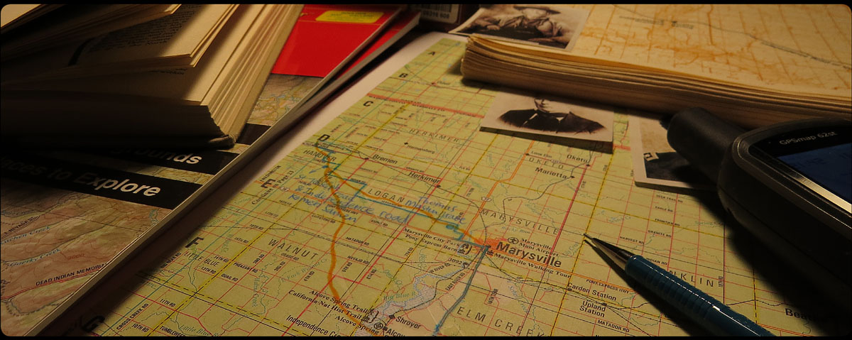
The person I’m talking to is Jill, caretaker of the Pony Express Station in Marysville, Kansas. This limestone building is the only surviving station of the legendary mail service that operated from 1860 to 1861. It’s a museum now, and this morning I paid it a visit. Fortunately Jill isn’t offended by my thoughtless remark, and I get a very good tour around the museum.
The Pony Express route and the Oregon Trail have a very obvious connection: both ran along the Platte and Sweetwater Rivers.
The service originated in a very strong desire by the people of California for a fast and reliable mail service. Normally the mail would go by steamship, then overland through Panama, and from there again by sea. But this usually took about five long weeks and sometimes the mail wouldn’t even arrive at all.
There had been some experimenting already with an overland mail service: by mule and even by camel, but it took three men to do the job properly in 1860: business partners Russel, Majors and Waddell. They decided to start a mail service by horse that could deliver the mail from St Joseph to San Francisco in just ten days. They did this at their own expense, but hoped that eventually it would lead to a lucrative government assignment that would pay for all their expenses made.
It was no simple thing, to start this whole new enterprise from scratch. Between St. Joseph and San Francisco, a distance of 1,840 miles, there had to be a station every 10-15 miles, where fresh horses would be available for the riders. This was the distance a good horse could run without being exhausted. On level ground the distance between stations would be a little further apart, in the mountains the stations would be closer together.
Only the best horses would be good enough, because only a strong and fast horse would be able to outrun the Indian ponies. For the riders this would often mean the difference between life and death. Eventually a total sum of 87,000 dollars was invested in horses.
The riders had to be light men or boys, not over 120 pounds, and orphans were preferred. They were paid between 100 and 150 dollars a month, a fortune in those days, but for this they had to escape Indians, face wolves and bandits and try to survive snowstorms, thunderstorms, terrible desert heat and swirling rivers.
The mail was transported in a so-called mochila, a sort of leather overjacket that could be thrown over the saddle, so it would be very easy to take from the saddle and put on a fresh horse.
The service turned out to be a great success. Eventually a total of 34,753 pieces of mail were delivered, and not one was ever lost. Despite the huge success, the Pony Express service only lasted about 18 months; from April 1860 to October 1861. Not only were costs to keep the service running too high to be profitable, in 1861 the transcontinental telegraph line was completed, and a fast mail service was no longer needed.
Today I was finally able to ride some back roads. And who ever claims that Kansas is flat and boring must forever keep their mouth shut. What a beautiful land! The hills roll in every direction like a massive green carpet. Birds are everywhere. They sometimes pull the most bizarre stunts, right in front of the bike, out of bravery, or pure stupidity. I hold my breath every time this happens, and expect to see an explosion of feathers in one of my mirrors any moment. But somehow these stunt flyers always seem to get away with it.
The gravel roads are completely deserted, apart from a pick-up truck that meets me every once in a while. The driver always wears a baseball cap and without exception raises his hand to greet me. Apart from this rare oncoming traffic, my only other company on the prairie consists of the bike, the cows, the birds and the wind.
This morning I started from Topeka, Kansas. This is where the emigrants crossed the Kansas River. From 1844 on, this was done by ferry, because the river was often too deep and too wild to be crossed with the wagons. No such luxury for the livestock though; they had to swim to the other shore.
When the emigrants arrived at this crossing, they had been on the road for over a week. Everybody in the wagon train had got to know each other a little better, and now it was time to choose a ‘team captain’. This team captain would be the leader of the wagon train for the rest of the journey. He decided where and when the train would rest or spend the night and he decided what to do in special circumstances, when a leader was needed.
Jesse Applegate, who traveled to Oregon in 1843, described how a team captain was chosen. The candidates walked onto the prairie, and everybody walked behind his or her favorite candidate. The person who had collected the longest row would become the leader of the train.
When the emigrants traveled north of Topeka, they entered the territory of the Pawnee, and it was not unusual that every now and then horses would be stolen by these Indians. The Pawnee sometimes demanded horses or cattle for passing on their lands. Stubborn emigrants who refused to pay this ‘toll’ were often relieved of their stock at night. So to prevent cattle theft, a night guard was installed. But being alone on the dark prairie night, rookie night guards would often see shadows that weren’t there, and every now and then a cow or a mule was accidentally shot, just for being a little restless at night.
Today, at the end of a very hot day, I visited Alcove Spring. It’s a place that was often mentioned in emigrant diaries.
Not far from the spring was the crossing of the Big Blue River. It sometimes took a while before the river was low enough to cross. Until then, emigrants camped a few days around Alcove Spring. At this nice, shady spot under the trees, a lot of emigrants left their names in the stones next to the little stream. One of them was James Frazier Reed, who traveled in the Donner party: a group of emigrants on their way to California.
After James scratched his name in the rock, his company met with a lot of bad luck. They were late and snow in the Sierra Nevada was early in 1846. The Donner party was forced to stay in the mountains that winter, and things got so bad that some of the survivors ate the unfortunate companions that had already starved to death.
Only 45 people managed to survive this harsh winter. James Reed, who left his name here in Alcove Spring, was one of them. He would eventually settle in California.
The bad weather that was forecasted the day before yesterday eventually managed to find me last night, on a campground just outside Topeka, Kansas, where I am still. Thunderstorms on the prairie are notorious so extra rope and tent pegs were lying ready next to my inflatable bed. But the storm turned out to be a modest one, with just a single flash and one bang. After that it was mostly rain pouring down and that actually made it pretty cosy inside my little mobile home; the rain came rattling down on the canvas as I was reading in my sleeping bag, cosy and warm. And now, in the morning sun, the world looks new and refreshed.
In 1849 Edwin Bryant, an emigrant on his way to California, wrote: ‘As we approached what is called the…prairie, the road became much drier en less difficult. The vast prairie itself soon opened before us in all its grandeur and beauty. I had never before beheld extensive scenery of this kind’
Yesterday, as I was driving from Independence to the west, right through Kansas City, there wasn’t much ‘grandeur’ left. The only things reminiscent of the days of the trail, were the city neighborhoods called ‘Overland Park’, where emigrants camped by the thousands, waiting for their company to gather, the grass to be high enough for the animals to live on, and they themselves to be sufficiently prepared for the trip, and ‘Shawnee’, referring to a Shawnee Mission Post, which in those days was located in the middle of the green prairie grassland. Before me there is no longer a beautiful, vast prairie to be seen, only long concrete roads, on both sides a continuous row of malls, fastfood chains, car dealers, parking lots, tire shops and gas stations.
I tried to find ‘Lone Elm Campground’, about 25 miles from Independence. It was named after an enormous elm, three feet thick, and an important landmark on the empty prairie. This was the first camping spot for many emigrants, who by now had left the United States.
The only thing I saw yesterday was a stretch of unused land. It may well have been the spot, but it was private land, and to be honest I didn’t really feel like staying very long. I just wanted to move on, and leave the city and its asphalt behind.
In the town of Gardner, a few miles down the road, the trail split. The Santa Fe Trail went south, so basically this was where the Oregon Trail was born, going west from here.
Everything looked a lot more friendly. Not the open prairie from earlier days of course, but green grassy hills with trees and cattle, farms and creeks.
In Gardner I found out by accident that there was a Civil War expo. This war started more than 150 years ago, but the memory is very much alive today. All the things exposed in the small museum were brought together by local people; from the beautiful dresses, the antique guns, the photographs, the handicraft works, right to the last lead bullet that somebody once found in his back yard.
Outside the museum there were demonstrations of making mats out of old cloths using an old wagon wheel, of shooting an antique gun, and even of firing of a canon. Everybody was dressed in late nineteenth-century clothing, and General Ulysses S. Grant and Confederate General Robert E. Lee were present. I even saw Abraham Lincoln walking around, and he didn’t mind having his picture taken behind my fully packed Yamaha mule.
Today is my day off. Time for a little reflection, doing some chores, and making a plan for the upcoming days. I found a nice campground, where, apart from the wind, a honking train in the distance is all I hear. Quite an improvement compared to the four previous campgrounds , where I had to endure a combination of highway noise and trains thundering along, or highway noise and flying fighter jets.
Later on today I’ll put some stones on the railway tracks. Tonight I will sleep like a baby.
It all seemed simple: just follow Interstate 70 to the east, and it’ll take you straight to Independence, Missouri. Two hours of riding, max. But for reasons unknown to the rest of the world, some brilliant mind has decided, in the middle of the week, to close the highway in downtown Kansas City. No explanation, just some men with helmets and reflective vests, looking like Playmobil puppets, walking up and down in front of the road block, and a matrix board that says: ‘I-70 closed, use detour’. Another way of saying: ‘You’re on your own’.
Suddenly all the traffic on the ‘Main Street of Kansas’ has to cram through the same exit. My GPS goes into panic mode (‘turn back, wrong way! turn back!’). I decide to just go with the traffic flow. It’s impossible to stop here, and I assume that everyone else wants to go east too, because that is where the I-70 is going.
It turns out to be a good decision. As soon as the GPS has calmed down a little, it takes me without delay to the front door of the National Frontier Trails Museum, where I spend a nice hour looking around – mainly because it’s so cool inside.
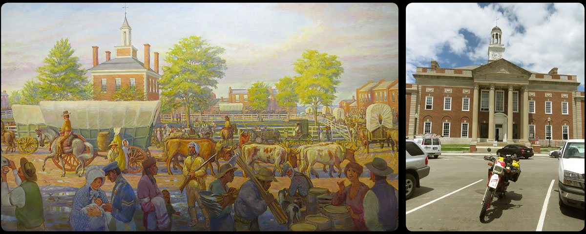
Thanks to the friendly lady behind the reception, a few blocks ahead I find Courthouse Square, with, indeed, the courthouse in the middle, the unofficial starting point of the trail. This is where, around 1840, the outfitting shops were found and where the emigrants could buy all the things they needed for the long journey west.
Here they bought oxen and mules, wagons, food, weapons. There were blacksmith’s shops where horses could be shod, and necessary adjustments or changes could be made to the wagons. I suppose there was a photographer who could make one last picture of the adventurer. A tent maker, an armorer, a doctor, a dentist. Maybe even a barber. This was where it all started, this was the centre of activity in the early days of the trail.
All the inconvenience of the last couple of days is forgotten when I park my bike right in front of the building. I take a look around, but it’s mostly because of my own fantasy that I see the historic part of town, helped by a beautiful painting from the museum I mentioned earlier. The courthouse itself has undergone some dramatic changes the last 150 years too; it’s hardly recognizable.
I take a few pictures and then I focus on the next challenge: trying to find something to eat and then a campground.
‘Okay, so here’s were you can put your tent. And right there are the restrooms. And this is where I want you to go in case of severe weather’.
I look outside the small office building. The sun is still shining, and I estimate the temperature to be in the seventies.
‘Uhm…are you expecting any…?’
‘Oh no, dear, that’s just what we have to tell everybody’.
Weather forecast for Kansas City tomorrow: ‘Isolated T-storms’.
In 1956, American engineers took a map of the US and drew a thick, straight line from Denver to Kansas City. This, they decided, will become the route of the Interstate 70 from Colorado to Kansas City.
I don’t know if it really happened like that, of course, but that’s how I imaged it yesterday, after 568 of mindkilling, butt-numbing miles of this seemingly endless stretch of concrete. Wednesday afternoon, some 40 miles from Boulder, I took a sharp turn to the left, and ever since it’s been one long, boring road. Exactly like everybody said it would be.
The I-70 may be a boring road to ride on, around me there is plenty to see. It’s amazing to see what people sometimes think they need to take with them on a trip.
The Kansas landscape isn’t boring either, in contrast to what I’ve been expecting. The first 100 miles weren’t very interesting, a little empty and flat, but the further I went to the east, the better it got. Especially the Flint Hills were beautiful. Green and sloping, with every once in a while a river that cut through the hills, curly like a snake. Cattle were grazing contently under the trees in the high grass and here and there I saw a wooden house in the middle of a sea of green. In the sun, from the highway, it all looked very idyllic.
Hopefully today will be just as nice. Just another 72 miles until I get to Independence, the real starting point of the trip. And hopefully after that I’ll use more than just the center of my tire.
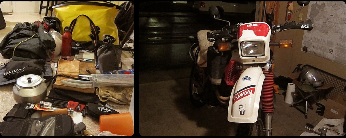
Everywhere in the house things are lying on the floor: tent, sleeping bag, maps, some spare parts for the bike, cameras, a ridiculous amount of cables and wires, batteries, tools, clothes and some food. All these things I somehow have to stuff into five bags: two small ones on the sides of the tank, a small tank bag, two 1,200 cubic inch waterproof bags on each side of the saddle, and a big duffle bag on top.
The amount of clothing I can take with me is reduced to the bare essentials. Only the things I’ll absolutely need the next few weeks, divided in half.
About a hundred times tonight I’m standing in the room with two things in my hands that I have to choose between: flipflops or sandals? I can’t take both. My favorite sweater? Or should I choose a warm one instead? Shoes or boots? Can I pack my little camping chair? Or is a tripod more than enough? Decisions, decisions…
Two books have survived the rigorous selection procedure: Gregory Franzwa’s The Oregon Trail Revisited and Traveling the Oregon Trail, by Julie Fanselow. Two excellent reference works I won’t be able to do without. Harper Collins Complete North American Wildlife will have to stay at home. I have to be strict.
The bike is all set, fortunately. Besides changing the bearings and collars of the swing arm, Anne managed to do a million other indispensable little chores on the XT, in record time. The bike is waiting patiently (and a little surprised about what all the fuss is about, so it seems) in our garage, unaware of the fact that tomorrow it will be mercilessly loaded like a mule.
Another hour or so of packing, collecting, selecting, and then off to bed. Tomorrow around noon I hope to have loaded the bike and start my trip.
‘It giet oan!’ (Untranslatable Frisian saying that means something like: ‘It’s time. Let’s do it!’)
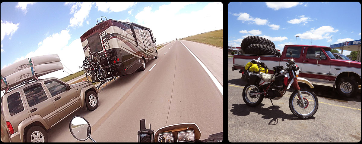
The 1,400 miles to Flagstaff didn’t do the Yamaha a lot of good. In a sense it was a successful test ride, because we discovered some problems, but it’s obvious that the bike isn’t ready for the trip yet.
Very early on during our trip to the south we noticed that there was something wrong with the rear suspension. When I was sitting on the fully loaded bike, and deliberately moved the seat up and down, we could hear the bearings and collars whimpering greaselessly. From underneath the luggage came an asthmathic wheezing. ‘Mmm…not good’, is Anne’s short and worried conclusion. He promises that, as soon as we are back in Boulder, he’ll give the rear suspension a thorough inspection.
But there is more. A few days after our return, Anne wants to show our guest from the Netherlands all the cool motorcycle trails around Boulder. But somewhere halfway Flagstaff Road, the Yamaha decides to just give up and die. They can kick-start as much as they want, but the engine remains silent. Revenge for the monster trip to Arizona maybe? I guess we’ll never know.
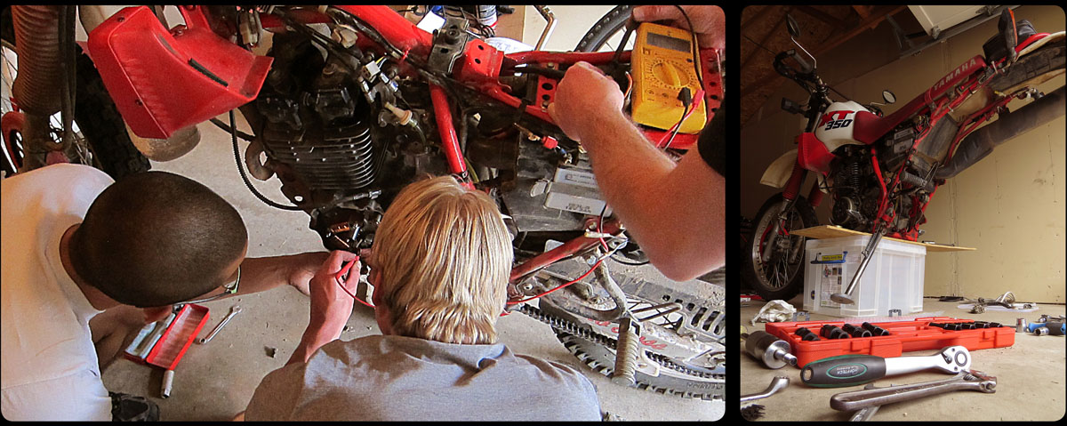
It is very hard for me not to get a little stressed over this. With just one week to go, my means of transportation is reduced to a motorcycle that sends -one- spark to the engine and then stops altogether.
The problem is electrical, that much is obvious. But what can it be? These kinds of complications are very hard to solve, because you can’t simply take a peek inside the wiring harness and see what the problem is. The only thing to do is testing and trying to discover what the cause may be. Sometimes these problems appear to have solved themselves, but then it often means you’re in even bigger trouble; it is never clear if the problem is really solved in some magical way, or that you are riding on a kind of electrical time-bomb that can stop working any moment.
Fortunately , our guest from the Netherlands holds a PhD in electrical engineering. Striking, to say the least. Together with Anne and our helpful neighbor Jon he voluntarily spends a few hours of his vacation in our garage, multimeter in hand.
The three of them decide to use Anne’s XT as a donor bike. When they presume a certain problem, they take off the part from Anne’s bike and use it on mine. This way, one after the other possible cause is excluded. Like three experienced surgeons they keep getting closer to the electrical heart of the motorcycle. Deeper and deeper they dig in the aluminum and steel armor of the bike and eventually they reach the stator of the generator. Here they see what the culprit is: one of the wires that lead to the ignition generator coil is stuck behind the coil and the isolation is slightly damaged by 25 years of vibrations. It is easily fixed with some gasket maker and a few minutes later, life is kicked back into the bike.
One problem solved, one to go…
The Yamaha has a brand new rear tire, I dug the saddlebags out of a moving box, Anne made an electrical supply for the GPS and a loader for the camera battery, there’s an empty SD card in the camera and new oil in the engine block. It’s time for a test ride.
Destination: Flagstaff, Arizona, where the yearly Overland Expo is being held. We should be able to make it in seven days; three days to get there, one day to have a look around on the expo, and three days to ride back to Boulder. Pretty tight schedule, but it should be possible.
After two and a half days riding -including the inevitable tinkering- we finally leave the enormous state of Colorado. At the end of the third day, we arrive in Flagstaff, our butts feeling like lifeless wood.
Just south of the city, in the wooded area around Mormon Lake, is where the expo is being held. Everything that has anything to do with overland travel is gathered here; special (camping) trucks, an off-road practice course for 4×4 cars, a motorcycle off-road course. You can find many stands where you can buy anything you can think of that you could possibly need on an overland journey. There are travelers, some of whom have brought their own vehicles and share their stories and experiences. There’s also a special tent for travel writers and here I meet my heroes Ted Simon, writer of ‘Jupiter’s travels’ (together with ‘Blue Highways’ the best travel book I know) and Lois Pryce, writer of ‘Lois on the Loose’ and ‘Red Tape and White Knuckles’, both a big inspiration. A tent printed with the name and photograph of Charley Boorman (‘The Long Way Round’) suggests that he’s also one of the guests, but in the time we are at the expo, there is no Charley to be seen.
In a little wooden building right next to the Expo terrain, films are shown as part of the Adventure travel film festival, the theme of course being overland travel. Here we see a fantastic film about 4 Czechs traveling in two Trabant cars from Prague to South Africa and we witness the premiere of ‘Mondo Sahara’, a project of the flamboyant Englishman Austin Vince. This film is the story of seven men, three Americans and four Brits, who travel from England to Mauritania on second hand Honda off-road motorcycles. It’s not only an adventurous motorcycle journey through an exceptionally wet summer in Europe and a stinking hot but beautiful Sahara, but also an acquaintance with the ‘dangerous’ Islamic country of Mauritania, which doesn’t turn out to be as dangerous as we think it is. Another point Austin Vince is trying to make with this film is that you don’t need a 20,000 dollar BMW GS with all the Touratech accessories that money can buy to make a fantastic trip. An inspiring and at times hilarious movie.
One whole day of adventure is more than enough for Anne and me, so on Sunday we climb on our bikes again to start our trip home. We have 750 miles ahead of us, but on the way back we decide to take a few off-road detours. After all, this is a test ride we’re doing here.
In the Manti-La Sal National Forest in Utah on our way to Monticello, we stumble across a couple in an enormous four wheel drive that’s stuck in the snow. The four of us eventually manage to turn the truck around and they go safely back to civilization. Something we should have done too, but we decide to go on down the road. There can’t be more than a few patches of snow ahead, we think, since it’s almost June.
One and a half hours later we come slogging out of the last snow, wet and tired. Lesson learned; test riding is hard work, and spring in the mountains doesn’t fall in May.
There were a number of requirements that I wanted my bike to meet for this trip. I wanted to ride it on the highway as well as off road. It didn’t need to be some ‘speed machine’ – after all, this was all about the travelling, not about reaching my destination as fast as possible.
It was more important that it was an affordable and economic bike. Another specification I had was that I didn’t want it to be too heavy. I needed to be able to pick up the bike on my own, and keep it upright in all situations. Preferably it shouldn’t be too high, so I could always reach the ground easily and move the bike around. And finally it had to be a bike that was reliable and easy to work on, so that for a rookie mechanic such as myself it would be possible to do some basic maintenance.
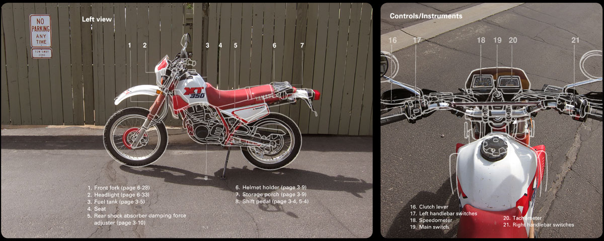
Quite a list of demands. But there was one bike in particular that met all the specifications mentioned above: the Yamaha XT 350. Affordable and, at only 285 lbs, light and agile. Mileage: about 70 miles to the gallon. The reliable little Yamaha has been shipped from Japan to the rest of the world for 15 years and all this time hardly changed mechanically. ‘Never change a winning team’, is what they must have thought in Iwata. I think the only experimenting that was ever done was with the livery design of the bike. And as is the custom with experiments, the results vary dramatically.
The Yamaha is a small bike, and certainly not a fast one. When I try to ride faster than 60 miles per hour things get pretty uncomfortable. But it is a sturdy little thing that has proven itself by now in the big motorcycle world. Hopefully the bike will last the full 3,800 miles. Long days on the road, riding in the heat of the day, dust and sand…it’s not going to be easy on it.
But if ever a bike was made for these kinds of trips, it is this small Japanese machine!
Although emigrants traveling to Oregon and California came from all over de US, it was mainly the towns along the Missouri River where people gathered and left for the west every spring. One of these jumping-off places was Independence, and this small town will also be my starting point for this trip.
So here’s the plan. From Independence (which today is merged into Kansas City) I’ll start travelling south along what was known as the Santa Fe Trail, a popular trading trail to Santa Fe, Mexico. Very soon I’ll turn west towards the Great Plains, a vast and mostly flat land.
Via Marysville, Kansas my route will roughly go in northwesterly direction, a route that will eventually lead me to the banks of the South Platte. I’ll follow this river for about 150 miles until right after the town of Ogallala, where I will cross it and from then on follow the North Platte. This river I’ll follow for about 260 miles deep into Wyoming. In Casper, Wyoming I’ll leave the Platte and will roughly course into southwesterly direction. This will take me to the Sweetwater River, which I will follow until the Continental Divide.
South Pass will take me over the Rocky Mountains, to the other side of the Great Divide.
Lyman, Wyoming is going to be the most southern tip of my route through Wyoming. Right after the small town I’ll head in a northeasterly direction. Just before I reach Idaho, I’ll come across the US 30. This road going north next to the Bear River has practically been rolled out over the original Oregon Trail. Once I’ve reached Idaho I’ll keep riding on the US 30, that will keep following the Bear River for about 50 miles.
In Soda Springs the route will turn straight north. After a short visit through Fort Hall Indian Reservation, in Pocatello I’ll be back travelling the US 30. This road will eventually take me to the Snake River. After following it for about 150 miles, in Glenns Ferry I’ll cross it and ride south of the Danskin Mountains in a northwesterly direction. This will take me through Boise and into my fifth and last state: Oregon.
On it goes from here, straight into the Blue Mountains – the last big hurdle the emigrants had to take before they were overtaken by the first winter storms – until I reach the rugged Columbia River. I’ll follow this river for about 100 miles until The Dalles.
In this city, from 1849 on, emigrants had a choice; they could either sell all their livestock and wagons and travel the Columbia by boat. Or they could ride their wagons over the Barlow Road; a very basic, rugged road that led them in a long semi-circle around the south side of Mount Hood to their destination. I will choose this overland road, since it’s mostly highway along the river.
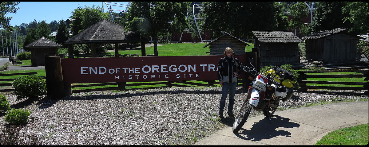
The Barlow Road will eventually take me to Portland, Oregon, where, if all goes well, I’ll arrive by the end of June. Well, at least that’s the plan. We’ll see how it goes in real life.
It’s not very hard to make this trip before I’m actually leaving. All I have to do is close my eyes, and a moment later I’m riding my bike across the vast and empty American desert, leaving a trail of dust behind for dramatic effect. Sagebrush next to the road is still shaking ‘no’ long after the bike has passed. The skull of a cow is lying on the sand beneath it, perfectly white because of the many years of burning hot sun. High above me, two vultures are keeping their hungry eyes on me. Rattlesnakes on the road I pass smoothly and without the least bit of trouble. And if I squint my eyes just a little more, I’ll see Indians on their ponies, whooping and yelling, riding along with me. No need to cook every night of course, because these friendly redskins will always leave a piece of the best buffalo meat for me, served with an ice cold beer.
Well, so much for fantasy. I’m sure reality will be quite different. But preparing for the trip has been a lot of fun so far too.
Night after night I’ve been devouring books about the trail, and the more I read, the more its history seems to come alive. Meaningless old portraits suddenly become faces, names become people and their stories. I discover that it wasn’t just a vast wilderness these people were crossing, it was a stage for all aspects of human life. Fighting, loving, giving birth, dying, it really wasn’t very different from the lives people left behind.
I’ve bought detailed roadmaps of Kansas, Nebraska, Wyoming, Idaho and Oregon and with the help of Gregory W. Franzwa’s historical maps I’m trying to figure out a route that will lead me past the original trail as closely as possible. That’s not always easy. As time passed, roads have changed, or the trail goes through private land or a park. Every now and then modern day obstacles have simply made it impossible to ride a certain part of the trail. A factory for example, or a dam. I’ll just have to ride around that. It’s quite a job, figuring out this route, but it brings me in the right mood.
So preparations are in full swing. Less than four weeks to go now. Not much if you think about it, but to me it seems like forever. I think I’ll close my eyes now for a few minutes…